
Science City topographic map
Interactive map
Click on the map to display elevation.
About this map
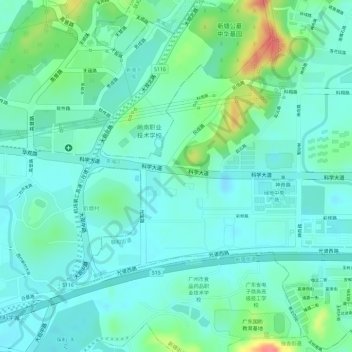
Name: Science City topographic map, elevation, terrain.
Average elevation: 27 m
Minimum elevation: 7 m
Maximum elevation: 82 m
Other topographic maps
Click on a map to view its topography, its elevation and its terrain.
Baiyun District
PRC > Guangdong > Guangzhou City
Baiyun District, Guangzhou City, Guangdong, PRC
Average elevation: 40 m