
Ambalangoda topographic map
Interactive map
Click on the map to display elevation.
About this map
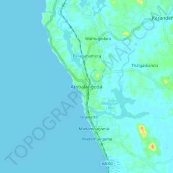
Name: Ambalangoda topographic map, elevation, terrain.
Location: Ambalangoda, Galle District, Southern Province, 80300, Sri Lanka (6.19884 80.01425 6.27884 80.09425)
Average elevation: 4 m
Minimum elevation: 0 m
Maximum elevation: 42 m