
K/E Ward topographic map
Interactive map
Click on the map to display elevation.
About this map
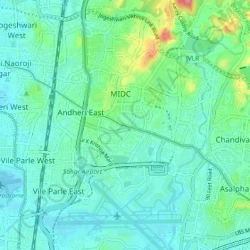
Name: K/E Ward topographic map, elevation, terrain.
Location: K/E Ward, Zone 3, Mumbai, Mumbai Suburban, Maharashtra, India (19.08168 72.84281 19.14356 72.89069)
Average elevation: 21 m
Minimum elevation: -1 m
Maximum elevation: 103 m
Other topographic maps
Click on a map to view its topography, its elevation and its terrain.