
Seine River topographic map
Interactive map
Click on the map to display elevation.
About this map
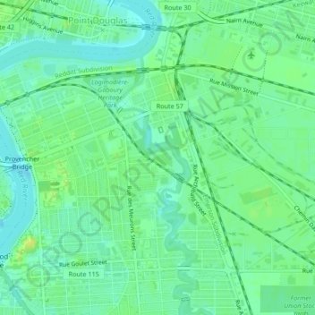
Name: Seine River topographic map, elevation, terrain.
Location: Seine River, Winnipeg, Manitoba, R2H 0G7, Canada (49.88228 -97.11364 49.90081 -97.10330)
Average elevation: 232 m
Minimum elevation: 225 m
Maximum elevation: 241 m
Other topographic maps
Click on a map to view its topography, its elevation and its terrain.
Tuxedo Industrial
Tuxedo Industrial, Winnipeg, Manitoba, Canada
Average elevation: 235 m