
Djerba Island topographic map
Interactive map
Click on the map to display elevation.
About this map
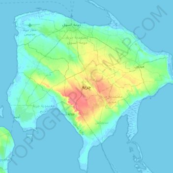
Name: Djerba Island topographic map, elevation, terrain.
Location: Djerba Island, ربانة, معتمدية جربة ميدون, Médenine, Tunisia (33.63144 10.72751 33.91558 11.06278)
Average elevation: 7 m
Minimum elevation: -5 m
Maximum elevation: 48 m