
Préfecture de Kouroussa topographic map
Interactive map
Click on the map to display elevation.
About this map
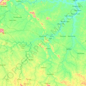
Name: Préfecture de Kouroussa topographic map, elevation, terrain.
Location: Préfecture de Kouroussa, Kankan, Guinée (9.59512 -10.89240 11.42360 -9.28466)
Average elevation: 425 m
Minimum elevation: 337 m
Maximum elevation: 868 m
Other topographic maps
Click on a map to view its topography, its elevation and its terrain.