
Rajgundha topographic map
Interactive map
Click on the map to display elevation.
About this map
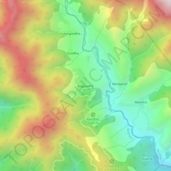
Name: Rajgundha topographic map, elevation, terrain.
Location: Rajgundha, Baijnath, Kangra, Himachal Pradesh, India (32.07109 76.74612 32.11109 76.78612)
Average elevation: 2,644 m
Minimum elevation: 2,141 m
Maximum elevation: 3,328 m