
Kufri topographic map
Interactive map
Click on the map to display elevation.
About this map
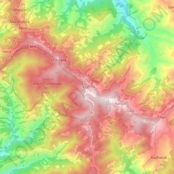
Name: Kufri topographic map, elevation, terrain.
Average elevation: 2,095 m
Minimum elevation: 1,345 m
Maximum elevation: 2,720 m
Kufri is located at 31°06′N 77°15′E / 31.10°N 77.25°E / 31.10; 77.25. It has an average elevation of 2,720 metres (8923 feet).