
Nehru Park topographic map
Interactive map
Click on the map to display elevation.
About this map
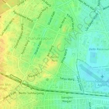
Name: Nehru Park topographic map, elevation, terrain.
Location: Nehru Park, Chanakyapuri, New Delhi, Delhi, India (28.58542 77.18941 28.59579 77.19601)
Average elevation: 224 m
Minimum elevation: 211 m
Maximum elevation: 238 m
Other topographic maps
Click on a map to view its topography, its elevation and its terrain.