New Nagzira WLS topographic map
Interactive map
Click on the map to display elevation.
About this map
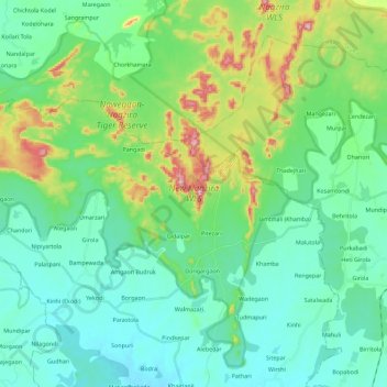
Name: New Nagzira WLS topographic map, elevation, terrain.
Average elevation: 308 m
Minimum elevation: 246 m
Maximum elevation: 506 m

Click on the map to display elevation.
Name: New Nagzira WLS topographic map, elevation, terrain.
Average elevation: 308 m
Minimum elevation: 246 m
Maximum elevation: 506 m