
Armagh topographic map
Interactive map
Click on the map to display elevation.
About this map
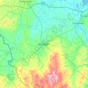
Name: Armagh topographic map, elevation, terrain.
Average elevation: 85 m
Minimum elevation: 10 m
Maximum elevation: 359 m
Other topographic maps
Click on a map to view its topography, its elevation and its terrain.
Killylea
United Kingdom > Northern Ireland > County Armagh > Armagh
Killylea, Armagh, County Armagh, Northern Ireland, BT60 4LN, United Kingdom
Average elevation: 73 m