
Leuven topographic map
Interactive map
Click on the map to display elevation.
About this map
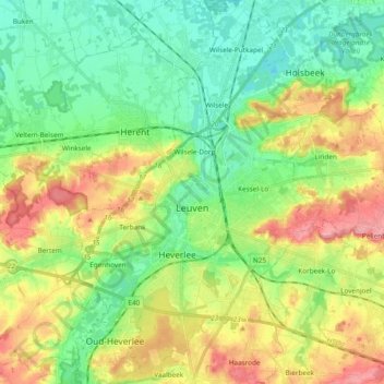
Name: Leuven topographic map, elevation, terrain.
Location: Leuven, Flemish Brabant, Flanders, Belgium (50.82421 4.64030 50.94407 4.77053)
Average elevation: 43 m
Minimum elevation: 4 m
Maximum elevation: 107 m