
Make a donation
Gemeinde Kössen topographic map
Click on the map to display elevation.
Make a donation
Gemeinde Kössen
Kössen's topography lends itself to air sports in the summer months. The surrounding mountain massifs create great thermals, which are near-perfect for hang gliding and paragliding flights, whilst the valley-floor makes safe landing-grounds, as it is broad, flat and mostly meadow-land; furthermore, the winter ski-lifts allow equal access to the summits in their off-season, for the new market of air-sports adventurers.
Make a donation
About this map
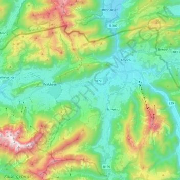
Name: Gemeinde Kössen topographic map, elevation, terrain.
Location: Gemeinde Kössen, Bezirk Kitzbühel, Tyrol, 6345, Austria (47.59728 12.31908 47.69638 12.52534)
Average elevation: 979 m
Minimum elevation: 562 m
Maximum elevation: 1,977 m
Make a donation
Other topographic maps
Click on a map to view its topography, its elevation and its terrain.