
Thank you for supporting this site ❤️
Make a donation
Make a donation
Kalher topographic map
Click on the map to display elevation.
Thank you for supporting this site ❤️
Make a donation
Make a donation
About this map
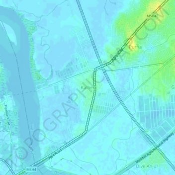
Name: Kalher topographic map, elevation, terrain.
Location: Kalher, Bhiwandi, Thane, Maharashtra, 400607, India (19.22706 72.99621 19.26706 73.03621)
Average elevation: 3 m
Minimum elevation: -3 m
Maximum elevation: 20 m
Thank you for supporting this site ❤️
Make a donation
Make a donation