
Maidenhead topographic map
Click on the map to display elevation.
About this map
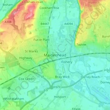
Name: Maidenhead topographic map, elevation, terrain.
Location: Maidenhead, Berkshire, England, SL6 1QB, United Kingdom (51.48274 -0.75974 51.56274 -0.67974)
Average elevation: 41 m
Minimum elevation: 16 m
Maximum elevation: 113 m
Other topographic maps
Click on a map to view its topography, its elevation and its terrain.