
Río Ambi topographic map
Interactive map
Click on the map to display elevation.
About this map
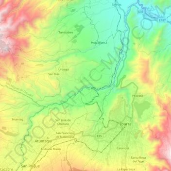
Name: Río Ambi topographic map, elevation, terrain.
Location: Río Ambi, Atuntaqui, Imbabura, EC100350, Ecuador (0.29577 -78.25081 0.50006 -78.10541)
Average elevation: 2,285 m
Minimum elevation: 1,487 m
Maximum elevation: 3,625 m