
Thank you for supporting this site ❤️
Make a donation
Make a donation
Mont Mézenc topographic map
Click on the map to display elevation.
Thank you for supporting this site ❤️
Make a donation
Make a donation
Mont Mézenc
Le mont Mézenc [meˈzɛ̃] est un sommet montagneux d'origine volcanique situé au sud-est du Massif central, à la limite entre les départements de la Haute-Loire et de l'Ardèche. Il culmine à 1 753 m d'altitude au cœur du massif du Mézenc. Il est situé sur la même ligne de crête que le mont Gerbier-de-Jonc, entre Velay et Vivarais, sur la ligne de partage des eaux entre l'Atlantique et la Méditerranée.
Thank you for supporting this site ❤️
Make a donation
Make a donation
About this map
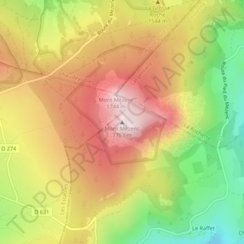
Name: Mont Mézenc topographic map, elevation, terrain.
Average elevation: 1,488 m
Minimum elevation: 1,200 m
Maximum elevation: 1,739 m
Thank you for supporting this site ❤️
Make a donation
Make a donation
Other topographic maps
Click on a map to view its topography, its elevation and its terrain.