
Kunihar topographic map
Interactive map
Click on the map to display elevation.
About this map
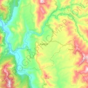
Name: Kunihar topographic map, elevation, terrain.
Location: Kunihar, Arki, Solan, Himachal Pradesh, 173208, India (31.03887 76.92072 31.11887 77.00072)
Average elevation: 956 m
Minimum elevation: 696 m
Maximum elevation: 1,306 m
Other topographic maps
Click on a map to view its topography, its elevation and its terrain.
Batal
India > Himachal Pradesh > Arki
Batal, Arki, Solan District, Himachal Pradesh, 173208, India
Average elevation: 1,122 m