
Make a donation
Fatu Huku topographic map
Click on the map to display elevation.
Make a donation
Fatu Huku
The island is essentially a huge rock, looming steep-sided out of the ocean and rising to a flattened plateau with a maximum elevation of 361 metres (1,184 ft). Fatu Huku is the youngest of the volcanic Marquesas Islands, estimated to be only 1.3 million years old which accounts, in part, for its ruggedness as erosion has not yet carved out valleys and beaches. Coral is rare in the Marquesas but an ancient coral reef is found at the higher elevations of Fatu Huku, the reef being raised above the sea by the volcanic activity that formed the island.
Make a donation
About this map
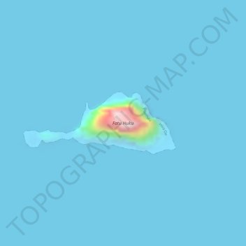
Name: Fatu Huku topographic map, elevation, terrain.
Average elevation: 8 m
Minimum elevation: -12 m
Maximum elevation: 342 m
Make a donation
Other topographic maps
Click on a map to view its topography, its elevation and its terrain.