
Thank you for supporting this site ❤️
Make a donation
Make a donation
Gemeinde Pill topographic map
Click on the map to display elevation.
Thank you for supporting this site ❤️
Make a donation
Make a donation
About this map
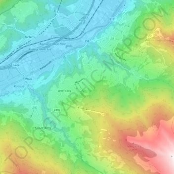
Name: Gemeinde Pill topographic map, elevation, terrain.
Location: Gemeinde Pill, Bezirk Schwaz, Tyrol, 6136, Austria (47.27055 11.66553 47.32977 11.78007)
Average elevation: 1,065 m
Minimum elevation: 534 m
Maximum elevation: 2,351 m
Thank you for supporting this site ❤️
Make a donation
Make a donation
Other topographic maps
Click on a map to view its topography, its elevation and its terrain.
Thank you for supporting this site ❤️
Make a donation
Make a donation
Thank you for supporting this site ❤️
Make a donation
Make a donation
Thank you for supporting this site ❤️
Make a donation
Make a donation