
Tux Alps topographic map
Interactive map
Click on the map to display elevation.
About this map
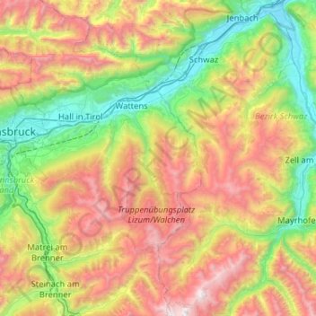
Name: Tux Alps topographic map, elevation, terrain.
Location: Tux Alps, Wattenberg, Innsbruck-Land, Tyrol, Austria (47.06229 11.38718 47.40794 11.90190)
Average elevation: 1,555 m
Minimum elevation: 520 m
Maximum elevation: 3,226 m