
Thank you for supporting this site ❤️
Make a donation
Make a donation
Fairmont topographic map
Click on the map to display elevation.
Thank you for supporting this site ❤️
Make a donation
Make a donation
About this map
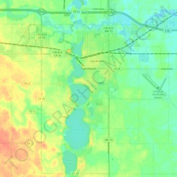
Name: Fairmont topographic map, elevation, terrain.
Location: Fairmont, Martin County, Minnesota, 56031, United States (43.59977 -94.51249 43.68514 -94.40753)
Average elevation: 361 m
Minimum elevation: 344 m
Maximum elevation: 385 m
Thank you for supporting this site ❤️
Make a donation
Make a donation
Other topographic maps
Click on a map to view its topography, its elevation and its terrain.