
Copăcel topographic map
Interactive map
Click on the map to display elevation.
About this map
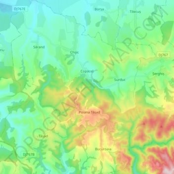
Name: Copăcel topographic map, elevation, terrain.
Location: Copăcel, Bihor, Romania (46.91199 22.09240 47.03011 22.23751)
Average elevation: 280 m
Minimum elevation: 169 m
Maximum elevation: 566 m
Other topographic maps
Click on a map to view its topography, its elevation and its terrain.