
Dorado topographic map
Interactive map
Click on the map to display elevation.
About this map
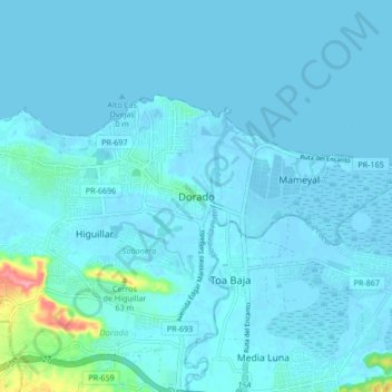
Name: Dorado topographic map, elevation, terrain.
Location: Dorado, Puerto Rico, 00646, United States (18.41938 -66.30153 18.49938 -66.22153)
Average elevation: 7 m
Minimum elevation: -3 m
Maximum elevation: 92 m
Dorado is located in Puerto Rico's Northern Karst region. Much of its geology consists of alluvial and coastal/estuarine sediments of Quaternary age and limestones of Tertiary age. The limestones are mostly in the south part of the municipality, in Espinosa, Maguayo and Rio Lajas barrios. These limestones exhibit mature karst topography of great beauty. It has been subjected to extensive quarrying, which have left unsightly scars in the landscape. Some local communities have gathered efforts to minimize quarrying and improve land management to protect the remaining karst topography and the fauna and flora that lives in it.