
Zunheboto topographic map
Interactive map
Click on the map to display elevation.
About this map
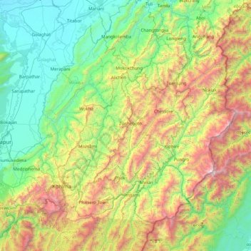
Name: Zunheboto topographic map, elevation, terrain.
Location: Zunheboto, Nagaland, 798620, India (25.30000 93.80000 26.70000 95.20000)
Average elevation: 1,010 m
Minimum elevation: 78 m
Maximum elevation: 3,767 m