
Thank you for supporting this site ❤️
Make a donation
Make a donation
Alvorninha topographic map
Click on the map to display elevation.
Thank you for supporting this site ❤️
Make a donation
Make a donation
About this map
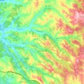
Name: Alvorninha topographic map, elevation, terrain.
Location: Alvorninha, Caldas da Rainha, Leiria, Portugal (39.35945 -9.08384 39.42362 -8.98250)
Average elevation: 125 m
Minimum elevation: 33 m
Maximum elevation: 238 m
Thank you for supporting this site ❤️
Make a donation
Make a donation
Other topographic maps
Click on a map to view its topography, its elevation and its terrain.