
Thank you for supporting this site ❤️
Make a donation
Make a donation
Steglitz-Zehlendorf topographic map
Click on the map to display elevation.
Thank you for supporting this site ❤️
Make a donation
Make a donation
About this map
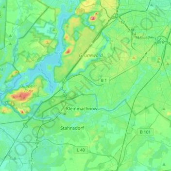
Name: Steglitz-Zehlendorf topographic map, elevation, terrain.
Location: Steglitz-Zehlendorf, Berlin, Germany (52.38723 13.08835 52.47184 13.37160)
Average elevation: 45 m
Minimum elevation: 26 m
Maximum elevation: 114 m
Thank you for supporting this site ❤️
Make a donation
Make a donation
Other topographic maps
Click on a map to view its topography, its elevation and its terrain.