
Bekabad topographic map
Interactive map
Click on the map to display elevation.
About this map
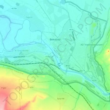
Name: Bekabad topographic map, elevation, terrain.
Location: Bekabad, Tashkent Region, Uzbekistan (40.18935 69.20142 40.25228 69.30387)
Average elevation: 317 m
Minimum elevation: 285 m
Maximum elevation: 432 m