
Roseau County topographic map
Interactive map
Click on the map to display elevation.
About this map
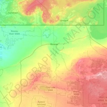
Name: Roseau County topographic map, elevation, terrain.
Location: Roseau County, Minnesota, United States (48.54052 -96.40663 49.00008 -95.09289)
Average elevation: 341 m
Minimum elevation: 308 m
Maximum elevation: 404 m