
Ashford topographic map
Interactive map
Click on the map to display elevation.
About this map
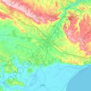
Name: Ashford topographic map, elevation, terrain.
Location: Ashford, Kent, South East, England, United Kingdom (50.98949 0.59034 51.27024 1.02921)
Average elevation: 60 m
Minimum elevation: -2 m
Maximum elevation: 199 m