
Tjørnuvík topographic map
Interactive map
Click on the map to display elevation.
About this map
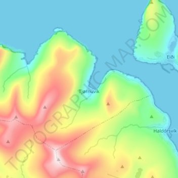
Name: Tjørnuvík topographic map, elevation, terrain.
Location: Tjørnuvík, Streymoy region, 445, Faroe Islands (62.26879 -7.23197 62.31033 -7.10281)
Average elevation: 227 m
Minimum elevation: -8 m
Maximum elevation: 764 m