
La Pedrera topographic map
Interactive map
Click on the map to display elevation.
About this map
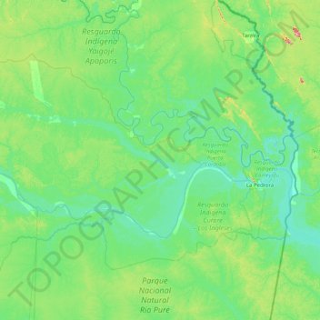
Name: La Pedrera topographic map, elevation, terrain.
Location: La Pedrera, Amazonas, Colombia (-2.00343 -70.49685 -0.38617 -69.39523)
Average elevation: 115 m
Minimum elevation: 57 m
Maximum elevation: 513 m