
Pickaway County topographic map
Interactive map
Click on the map to display elevation.
About this map
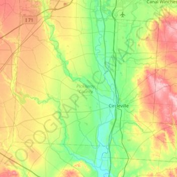
Name: Pickaway County topographic map, elevation, terrain.
Location: Pickaway County, Ohio, USA (39.46806 -83.26681 39.81254 -82.73152)
Average elevation: 246 m
Minimum elevation: 192 m
Maximum elevation: 342 m
Other topographic maps
Click on a map to view its topography, its elevation and its terrain.
Cheviot Hills
USA > Ohio > Cheviot Hills
Cheviot Hills, Clark County, Ohio, 45505, USA
Average elevation: 321 m
Childrens Park
Childrens Park, High Street Corridor, Columbus, Franklin County, Ohio, USA
Average elevation: 228 m
New Harrisburg
USA > Ohio > New Harrisburg
New Harrisburg, Harrison Township, Carroll County, Ohio, USA
Average elevation: 354 m
Burton Lake
USA > Ohio > Burton Lake
Burton Lake, Burton Township, Geauga County, Ohio, 44021, USA
Average elevation: 348 m