
Banda Aceh topographic map
Interactive map
Click on the map to display elevation.
About this map
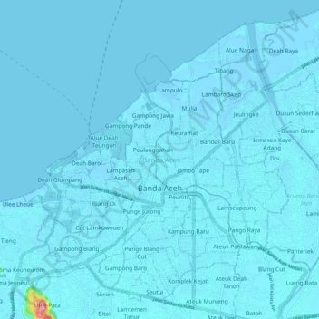
Name: Banda Aceh topographic map, elevation, terrain.
Location: Banda Aceh, Aceh, Sumatra, Indonesia (5.51639 95.27506 5.60724 95.37777)
Average elevation: 5 m
Minimum elevation: -3 m
Maximum elevation: 220 m
Other topographic maps
Click on a map to view its topography, its elevation and its terrain.
Lapangan Terbang
Indonesia > Aceh > Lapangan Terbang
Lapangan Terbang, Pegasing, Aceh Tengah, Aceh, Indonesia
Average elevation: 1,387 m
Mount Leuser
Mount Leuser, Kuta Panjang, Gayo Lues, Aceh, Indonesia
Average elevation: 2,556 m
Gunung Mugajah
Gunung Mugajah, Serbajadi, Aceh Timur, Aceh, Indonesia
Average elevation: 2,189 m
Gunung Bandahara
Gunung Bandahara, Putri Betung, Gayo Lues, Aceh, Indonesia
Average elevation: 2,634 m