
Thank you for supporting this site ❤️
Make a donation
Make a donation
Dighalia topographic map
Click on the map to display elevation.
Thank you for supporting this site ❤️
Make a donation
Make a donation
About this map
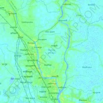
Name: Dighalia topographic map, elevation, terrain.
Location: Dighalia, Khulna District, Khulna Division, Bangladesh (22.82876 89.47783 22.99589 89.61093)
Average elevation: 3 m
Minimum elevation: -2 m
Maximum elevation: 11 m
Thank you for supporting this site ❤️
Make a donation
Make a donation
Other topographic maps
Click on a map to view its topography, its elevation and its terrain.