
Bell County topographic map
Interactive map
Click on the map to display elevation.
About this map
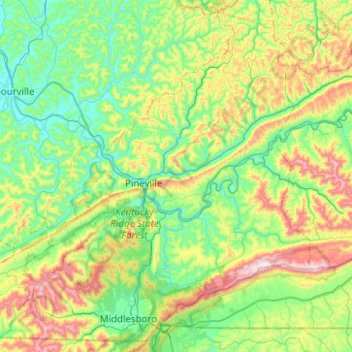
Name: Bell County topographic map, elevation, terrain.
Location: Bell County, Kentucky, USA (36.58258 -83.95724 36.95599 -83.45902)
Average elevation: 498 m
Minimum elevation: 286 m
Maximum elevation: 1,049 m
Other topographic maps
Click on a map to view its topography, its elevation and its terrain.
Mammoth Cave
USA > Kentucky > Mammoth Cave
Mammoth Cave, Edmonson County, Kentucky, USA
Average elevation: 214 m