Geolocate

Gómara topographic map

Interactive map

Click on the map to display elevation.

About this map

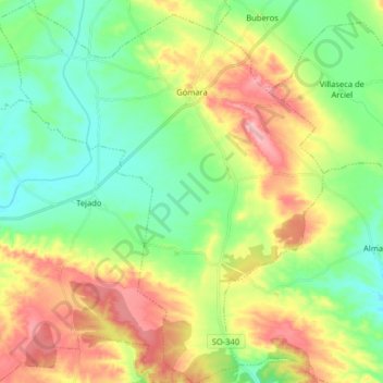
Name: Gómara topographic map, elevation, terrain.

Location: Gómara, Soria, Castile and León, Spain (41.53236 -2.30494 41.65217 -2.16887)

Average elevation: 1,031 m

Minimum elevation: 967 m

Maximum elevation: 1,136 m

Other topographic maps

Click on a map to view its topography, its elevation and its terrain.

La Jalva

Spain > Castile and León > Encinas de Abajo

Average elevation: 818 m

El Raso

Spain > Castile and León > Arenas de San Pedro

Average elevation: 1,770 m

Cerro de la Estrella

Spain > Castile and León > Cebreros

Average elevation: 1,006 m

León

Spain > Castile and León > León

Average elevation: 838 m

Gomia

Spain > Castile and León > Las Quintanillas

Average elevation: 847 m

Tejeda

Spain > Castile and León > Tejeda y Segoyuela > Tejeda

Average elevation: 941 m

La Jabera

Spain > Castile and León > Villar de Fallaves

Average elevation: 704 m

La Comilla

Spain > Castile and León > Aldealafuente

Average elevation: 993 m

Parapa

Spain > Castile and León > Briviesca

Average elevation: 730 m

Toroño

Spain > Castile and León > Porto

Average elevation: 1,495 m