Bentonville topographic map
Interactive map
Click on the map to display elevation.
About this map
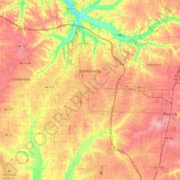
Name: Bentonville topographic map, elevation, terrain.
Location: Bentonville, Benton County, Arkansas, United States (36.27106 -94.32624 36.43871 -94.15459)
Average elevation: 387 m
Minimum elevation: 309 m
Maximum elevation: 436 m
Bentonville lies in the humid subtropical climate zone (Köppen Cfa) with influence from the humid continental climate type. Bentonville experiences all four seasons and does receive cold air masses from the north, however some of the Arctic masses are blocked by the higher elevations of the Ozarks. July is the hottest month of the year, with an average high of 89 °F (32 °C) and an average low of 66 °F (19 °C). Temperatures above 90 °F (32.2 °C) are common, with a high of 100 °F (37.8 °C) occurring about once per year on average. January is the coldest month with an average high of 46 °F (8 °C) and an average low of 24 °F (−4 °C). The city's highest temperature was 114 °F (45.6 °C), recorded in 1954. The lowest temperature recorded was −16 °F (−26.7 °C), in 1996.
Other topographic maps
Click on a map to view its topography, its elevation and its terrain.
Rogers
United States > Arkansas > Benton County
Rogers, Benton County, Arkansas, United States
Average elevation: 393 m
Beaver Lake
United States > Arkansas > Benton County > Goshen
Beaver Lake, Goshen, Benton County, Arkansas, 72757, United States
Average elevation: 394 m
Lost Bridge Village
United States > Arkansas > Benton County
Lost Bridge Village, Benton County, Arkansas, United States
Average elevation: 377 m
Maysville
United States > Arkansas > Benton County
Maysville, Benton County, Arkansas, 72747, United States
Average elevation: 323 m
Decatur
United States > Arkansas > Benton County
Decatur, Benton County, Arkansas, 72722, United States
Average elevation: 379 m
Gateway
United States > Arkansas > Benton County
Gateway, Benton County, Arkansas, 72733, United States
Average elevation: 467 m
Little Flock
United States > Arkansas > Benton County
Little Flock, Benton County, Arkansas, United States
Average elevation: 388 m
Springtown
United States > Arkansas > Benton County
Springtown, Benton County, Arkansas, 72734, United States
Average elevation: 388 m
Siloam Springs
United States > Arkansas > Benton County
Siloam Springs, Benton County, Arkansas, 72761, United States
Average elevation: 339 m
Hiwasse
United States > Arkansas > Benton County > Gravette
Hiwasse, Gravette, Benton County, Arkansas, 72739, United States
Average elevation: 394 m
Bella Vista
United States > Arkansas > Benton County
Bella Vista, Benton County, Arkansas, 72715, United States
Average elevation: 372 m
Benton Country Fair Grounds
United States > Arkansas > Benton County > Bentonville
Benton Country Fair Grounds, Bentonville, Benton County, Arkansas, United States
Average elevation: 384 m
Lake Avalon
United States > Arkansas > Benton County > Bella Vista
Lake Avalon, Bella Vista, Benton County, Arkansas, 72715, United States
Average elevation: 353 m
Rago
United States > Arkansas > Benton County > Bella Vista
Rago, Bella Vista, Benton County, Arkansas, 72715, United States
Average elevation: 378 m
Loch Lomond
United States > Arkansas > Benton County > Bella Vista
Loch Lomond, Bella Vista, Benton County, Arkansas, 72715, United States
Average elevation: 360 m
Dug Hill
United States > Arkansas > Benton County > Bella Vista
Dug Hill, Bella Vista, Benton County, Arkansas, 72715, United States
Average elevation: 344 m
Centerton
United States > Arkansas > Benton County
Centerton, Benton County, Arkansas, 72719, United States
Average elevation: 393 m
Pedro
United States > Arkansas > Benton County
Pedro, Benton County, Arkansas, United States
Average elevation: 334 m
Lake Windsor
United States > Arkansas > Benton County > Bella Vista
Lake Windsor, Bella Vista, Benton County, Arkansas, 72715, United States
Average elevation: 352 m
Silent Grove
United States > Arkansas > Benton County > Springdale
Silent Grove, Springdale, Benton County, Arkansas, 72762, United States
Average elevation: 394 m
Cave Springs
United States > Arkansas > Benton County
Cave Springs, Benton County, Arkansas, 72718, United States
Average elevation: 375 m
Gravette
United States > Arkansas > Benton County
Gravette, Benton County, Arkansas, United States
Average elevation: 356 m
Siloam Springs Lake
United States > Arkansas > Benton County > Siloam Springs
Siloam Springs Lake, Siloam Springs, Benton County, Arkansas, United States
Average elevation: 341 m
Healing Springs
United States > Arkansas > Benton County
Healing Springs, Benton County, Arkansas, United States
Average elevation: 365 m
Garfield
United States > Arkansas > Benton County
Garfield, Benton County, Arkansas, 72732, United States
Average elevation: 453 m
Oak Grove
United States > Arkansas > Benton County > Oak Grove
Oak Grove, Benton County, Arkansas, 72757, United States
Average elevation: 362 m
Lake Springdale
United States > Arkansas > Benton County > Springdale
Lake Springdale, Springdale, Benton County, Arkansas, United States
Average elevation: 392 m
Lowell
United States > Arkansas > Benton County
Lowell, Benton County, Arkansas, United States
Average elevation: 404 m
Sulphur Springs
United States > Arkansas > Benton County
Sulphur Springs, Benton County, Arkansas, United States
Average elevation: 308 m
Gentry
United States > Arkansas > Benton County
Gentry, Benton County, Arkansas, 72734, United States
Average elevation: 371 m
Bella Vista
United States > Arkansas > Benton County > Bella Vista > Bella Vista
Bella Vista, Benton County, Arkansas, 72715, United States
Average elevation: 359 m
Garfield
United States > Arkansas > Benton County > Garfield
Garfield, Benton County, Arkansas, 72732, United States
Average elevation: 453 m
Pea Ridge
United States > Arkansas > Benton County
Pea Ridge, Benton County, Arkansas, 72751, United States
Average elevation: 393 m