
Upper Empordà topographic map
Interactive map
Click on the map to display elevation.
About this map
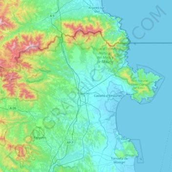
Name: Upper Empordà topographic map, elevation, terrain.
Location: Upper Empordà, Girona, Catalonia, Spain (42.09836 2.54202 42.48213 3.32225)
Average elevation: 194 m
Minimum elevation: -2 m
Maximum elevation: 1,431 m
Other topographic maps
Click on a map to view its topography, its elevation and its terrain.