
Neustift im Stubaital topographic map
Interactive map
Click on the map to display elevation.
About this map
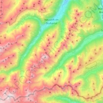
Name: Neustift im Stubaital topographic map, elevation, terrain.
Location: Neustift im Stubaital, Bezirk Innsbruck-Land, 6167, Austria (46.96249 11.09011 47.14528 11.37404)
Average elevation: 2,011 m
Minimum elevation: 909 m
Maximum elevation: 3,369 m