
Lyndoch topographic map
Click on the map to display elevation.
Lyndoch
Lyndoch is a town in Barossa Valley, located on the Barossa Valley Highway between Gawler and Tanunda, 58 km northeast of Adelaide. The town has an elevation of 175m and an average rainfall of 560.5mm. It is one of the oldest towns in South Australia.
About this map
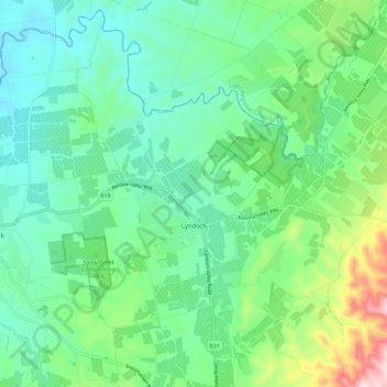
Name: Lyndoch topographic map, elevation, terrain.
Average elevation: 216 m
Minimum elevation: 100 m
Maximum elevation: 563 m
Other topographic maps
Click on a map to view its topography, its elevation and its terrain.