
Volterra topographic map
Interactive map
Click on the map to display elevation.
About this map
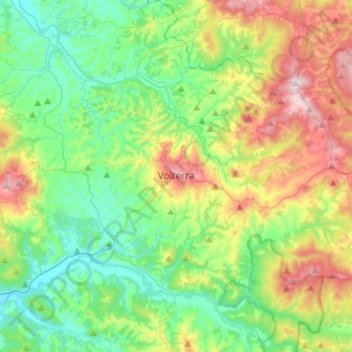
Name: Volterra topographic map, elevation, terrain.
Location: Volterra, Pisa, Tuscany, 56048, Italy (43.30215 10.76978 43.49742 11.01401)
Average elevation: 228 m
Minimum elevation: 44 m
Maximum elevation: 626 m