Geolocate

Lünen topographic map

Interactive map

Click on the map to display elevation.

About this map

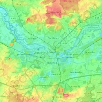
Name: Lünen topographic map, elevation, terrain.

Location: Lünen, Kreis Unna, Nordrhein-Westfalen, Deutschland (51.57802 7.41788 51.65267 7.59233)

Average elevation: 68 m

Minimum elevation: 41 m

Maximum elevation: 120 m

Die Stadt Lünen ist, anders als andere Städte in Nordrhein-Westfalen, verwaltungsmäßig nicht in Ortschaften (Stadtteile), sondern in statistische Bezirke gegliedert, die jedoch zugleich die Funktion von Ortsteilen/Stadtteilen haben. Das rasche Wachstum Lünens erforderte es, die Zahl der statistischen Bezirke mehrmals zu erhöhen; so besteht Lünen seit 2004 aus vierzehn statistischen Bezirken:

Wikipedia (CC-BY-SA 3.0)