
Thank you for supporting this site ❤️
Make a donation
Make a donation
Proctor topographic map
Click on the map to display elevation.
Thank you for supporting this site ❤️
Make a donation
Make a donation
About this map
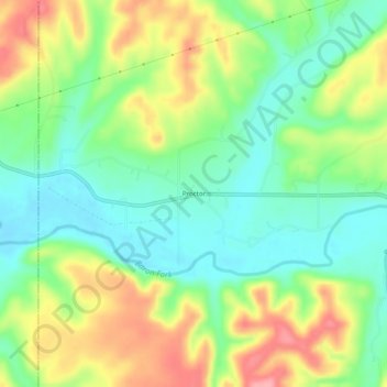
Name: Proctor topographic map, elevation, terrain.
Location: Proctor, Adair County, Oklahoma, United States (35.94620 -94.79745 35.98620 -94.75745)
Average elevation: 272 m
Minimum elevation: 228 m
Maximum elevation: 337 m
Thank you for supporting this site ❤️
Make a donation
Make a donation