Duiven topographic map
Interactive map
Click on the map to display elevation.
About this map
![Duiven topographic map, elevation, terrain](/pub/maps/relation/8rm2/pgv5k/thumbnail.jpg)
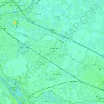
Name: Duiven topographic map, elevation, terrain.
Location: Duiven, Gelderland, Nederland (51.91233 5.96578 51.98186 6.06885)
Average elevation: 11 m
Minimum elevation: 5 m
Maximum elevation: 29 m
Other topographic maps
Click on a map to view its topography, its elevation and its terrain.
![Achterhoek topographic map, elevation, terrain](/pub/maps/node/41tp/h81klhm2/icon.jpg)
Achterhoek
Nederland > Gelderland > Lievelde
Achterhoek, Lievelde, Oost Gelre, Gelderland, Nederland, 7137 NC, Nederland
Average elevation: 54 m
![Harderwijk topographic map, elevation, terrain](/pub/maps/relation/4fgt/dhk14s/icon.jpg)
Harderwijk
Nederland > Gelderland > Harderwijk
Harderwijk, Gelderland, Nederland
Average elevation: 7 m
![Geldermalsen topographic map, elevation, terrain](/pub/maps/relation/g57/643gkl/icon.jpg)
Geldermalsen
Nederland > Gelderland > West Betuwe
Geldermalsen, West Betuwe, Gelderland, Nederland
Average elevation: 4 m
![Wageningen-Hoog topographic map, elevation, terrain](/pub/maps/node/81nh/7736rxdn/icon.jpg)
Wageningen-Hoog
Nederland > Gelderland > Wageningen
Wageningen-Hoog, Wageningen, Gelderland, Nederland, 6705 CH, Nederland
Average elevation: 27 m
![Voorthuizen topographic map, elevation, terrain](/pub/maps/relation/hkgt/bg6b3/icon.jpg)
Voorthuizen
Voorthuizen, Barneveld, Gelderland, Nederland
Average elevation: 15 m
![Wageningen topographic map, elevation, terrain](/pub/maps/relation/l414/51bf3/icon.jpg)
Wageningen
Nederland > Gelderland > Wageningen
Wageningen, Gelderland, Nederland
Average elevation: 14 m
![Lent topographic map, elevation, terrain](/pub/maps/relation/7wt6/fnxf3l/icon.jpg)
Lent
Nederland > Gelderland > Nijmegen
Lent, Nijmegen-Noord, Nijmegen, Gelderland, Nederland
Average elevation: 11 m
![Kranenburg topographic map, elevation, terrain](/pub/maps/node/6j14/x1m2x41h/icon.jpg)
Kranenburg
Kranenburg, Vorden, Bronckhorst, Gelderland, Nederland, 7251 LS, Nederland
Average elevation: 14 m
![Millingerwaard topographic map, elevation, terrain](/pub/maps/way/6rtf/dwv5q57/icon.jpg)
Millingerwaard
Nederland > Gelderland > Kekerdom
Millingerwaard, Kekerdom, Berg en Dal, Gelderland, Nederland
Average elevation: 11 m