
Puerto del Rosario topographic map
Interactive map
Click on the map to display elevation.
About this map
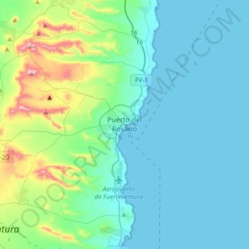
Name: Puerto del Rosario topographic map, elevation, terrain.
Location: Puerto del Rosario, Las Palmas, Canary Islands, Spain (28.41986 -14.09022 28.57720 -13.82555)
Average elevation: 109 m
Minimum elevation: 0 m
Maximum elevation: 664 m