
Bielefeld topographic map
Interactive map
Click on the map to display elevation.
About this map
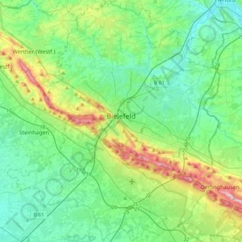
Name: Bielefeld topographic map, elevation, terrain.
Location: Bielefeld, North Rhine-Westphalia, Germany (51.91487 8.37782 52.11477 8.66335)
Average elevation: 127 m
Minimum elevation: 64 m
Maximum elevation: 322 m