
Chichester topographic map
Click on the map to display elevation.
About this map
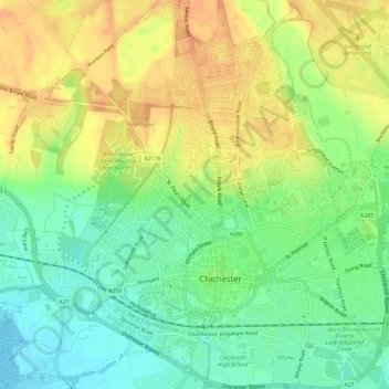
Name: Chichester topographic map, elevation, terrain.
Location: Chichester, West Sussex, England, United Kingdom (50.82589 -0.81106 50.86315 -0.75395)
Average elevation: 20 m
Minimum elevation: -1 m
Maximum elevation: 39 m
Other topographic maps
Click on a map to view its topography, its elevation and its terrain.