
South Lake Tahoe topographic map
Interactive map
Click on the map to display elevation.
About this map
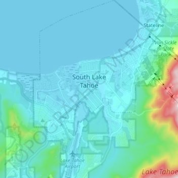
Name: South Lake Tahoe topographic map, elevation, terrain.
Average elevation: 1,979 m
Minimum elevation: 1,897 m
Maximum elevation: 2,680 m
According to the United States Census Bureau, the city has a total area of 16.6 square miles (43 km2), of which 10.2 square miles (26 km2) is land and 6.4 square miles (17 km2), or 38.80%, is water. Its elevation is about 6,237 feet (1,901 m) above sea level.