
Thank you for supporting this site ❤️
Make a donation
Make a donation
Radstadt topographic map
Click on the map to display elevation.
Thank you for supporting this site ❤️
Make a donation
Make a donation
About this map
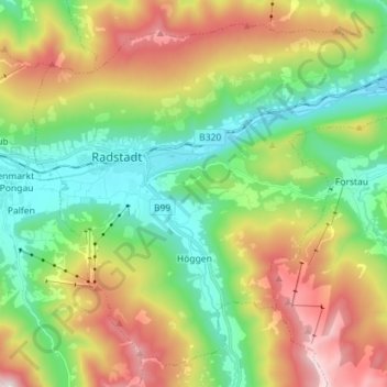
Name: Radstadt topographic map, elevation, terrain.
Location: Radstadt, Salzburg, 5550, Austria (47.33255 13.43186 47.41806 13.57418)
Average elevation: 1,185 m
Minimum elevation: 805 m
Maximum elevation: 1,955 m
Thank you for supporting this site ❤️
Make a donation
Make a donation
Other topographic maps
Click on a map to view its topography, its elevation and its terrain.